


Description
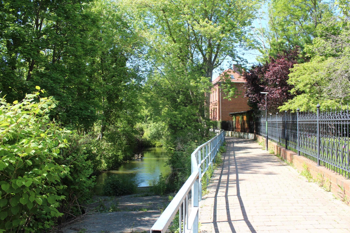
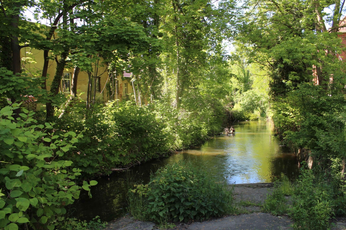
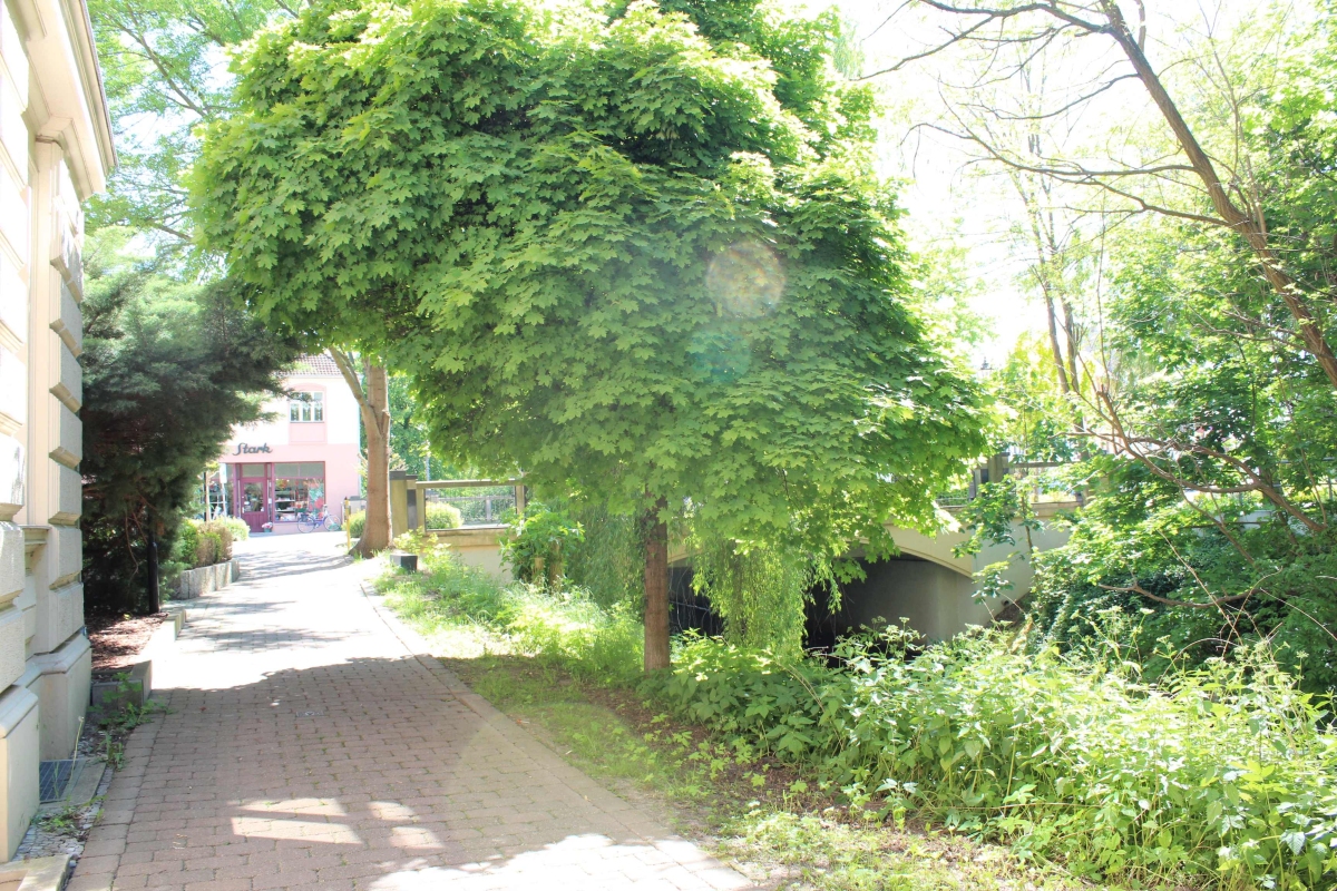
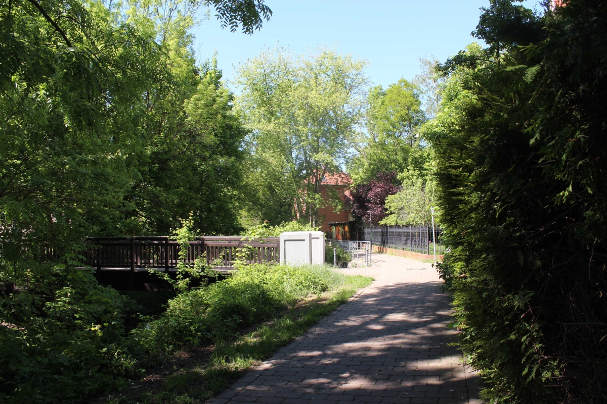
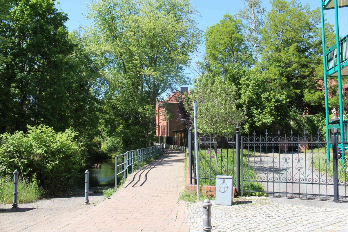
"The Path of Poets" ("Poetensteig") is a quiet, green promenade 730 m long, leading along the Engelneiße canal on the west side and bordering on the east side the housing estate and the former monastic suburb "Klostervorstadt".
Historical background
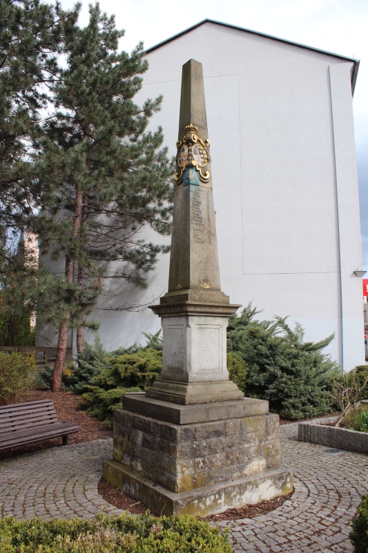
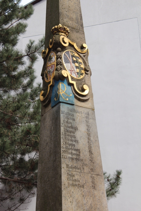
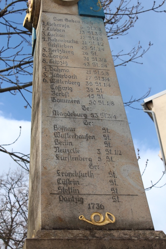
The creation of the network of distance poles of the Saxon post office dates back to the order of August II the Strong, established in the 18th century, whose aim was to measure and mark the distance of all important postal and trade routes within the Saxon electorate. This system was based on the Roman model, which was based on measuring distances in hours (1 hour = 4.53 km).
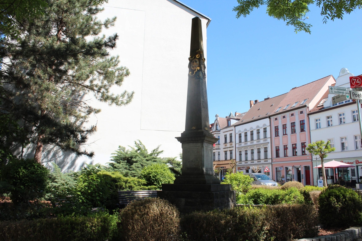
The original Guben postal pole was built either shortly before the death of Augustus the Strong or, as some sources state, in 1736. At that time, the pole was also next to the monastery mill. In 1883, the column was moved to Dreieck, located in the monastery suburb (Ger. Klostervorstadt). In 1938 it was moved again, this time near Egelneiß bridge (Ger. Egelneißbrücke), where 8 years later, on April 19, 1945, it was completely destroyed after the bridge was blown up. A fragment of the original Saxon column can still be found on the grounds of the local history museum "Sprucker Mühle". The column, which can be seen today at the descent to the Poet's Path (Ger. Poetensteig), is a replica created for the Workers' Day in 1989 by the Dresden sculptor Ralf Börnerow.

Poets' Path
Beginning: Berliner Str.
End: Alte Post Str.
path of the poets
Poets' Path: no data
Poets' Path: 730 m
24/7